Back to Academic Hub
Types of Maps
Explore different cartographic representations used in geography and spatial analysis. From property boundaries to climatic visualizations.
10
Map Types
4
Categories
Administrative
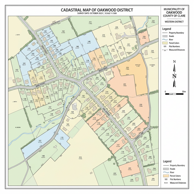
Cadastral Map
Detailed property boundaries and land ownership
View Full Map
Thematic
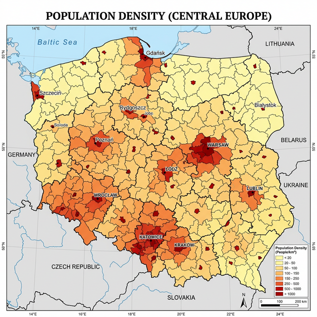
Thematic Map
Focuses on a specific theme like population density
View Full Map
Climatic
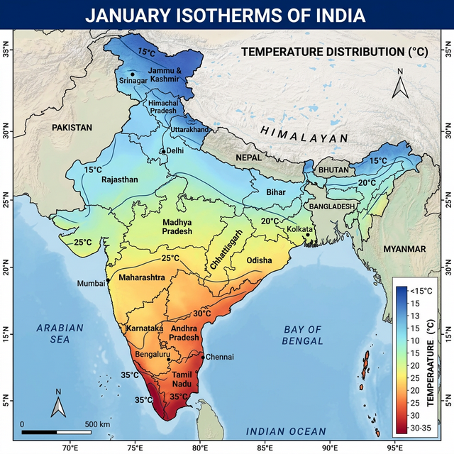
Isotherm Map
Shows areas of equal temperature
View Full Map
Climatic
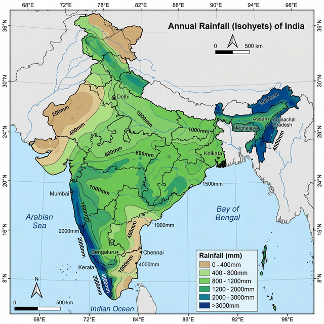
Isohyet Map
Shows areas of equal rainfall
View Full Map
Physical
Topographic Map
Detailed terrain, elevation, and natural features
View Full Map
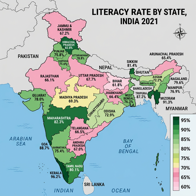
Thematic
Choropleth Map
Statistical data through shaded regions
View Full Map
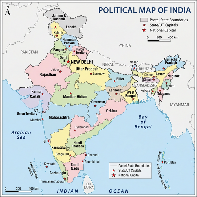
Administrative
Political Map
Government boundaries of countries and states
View Full Map
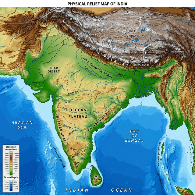
Physical
Physical Map
Focuses on geography like mountains and valleys
View Full Map
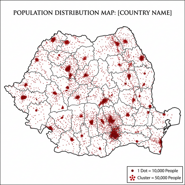
Thematic
Dot Distribution Map
Uses dots to show presence of a feature
View Full Map
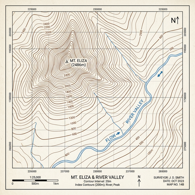
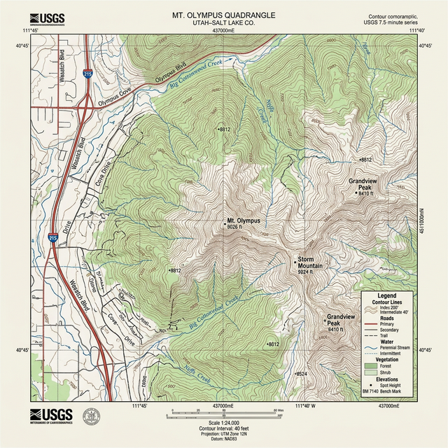
Physical
Contour Map
Shows elevation using contour lines
View Full Map